
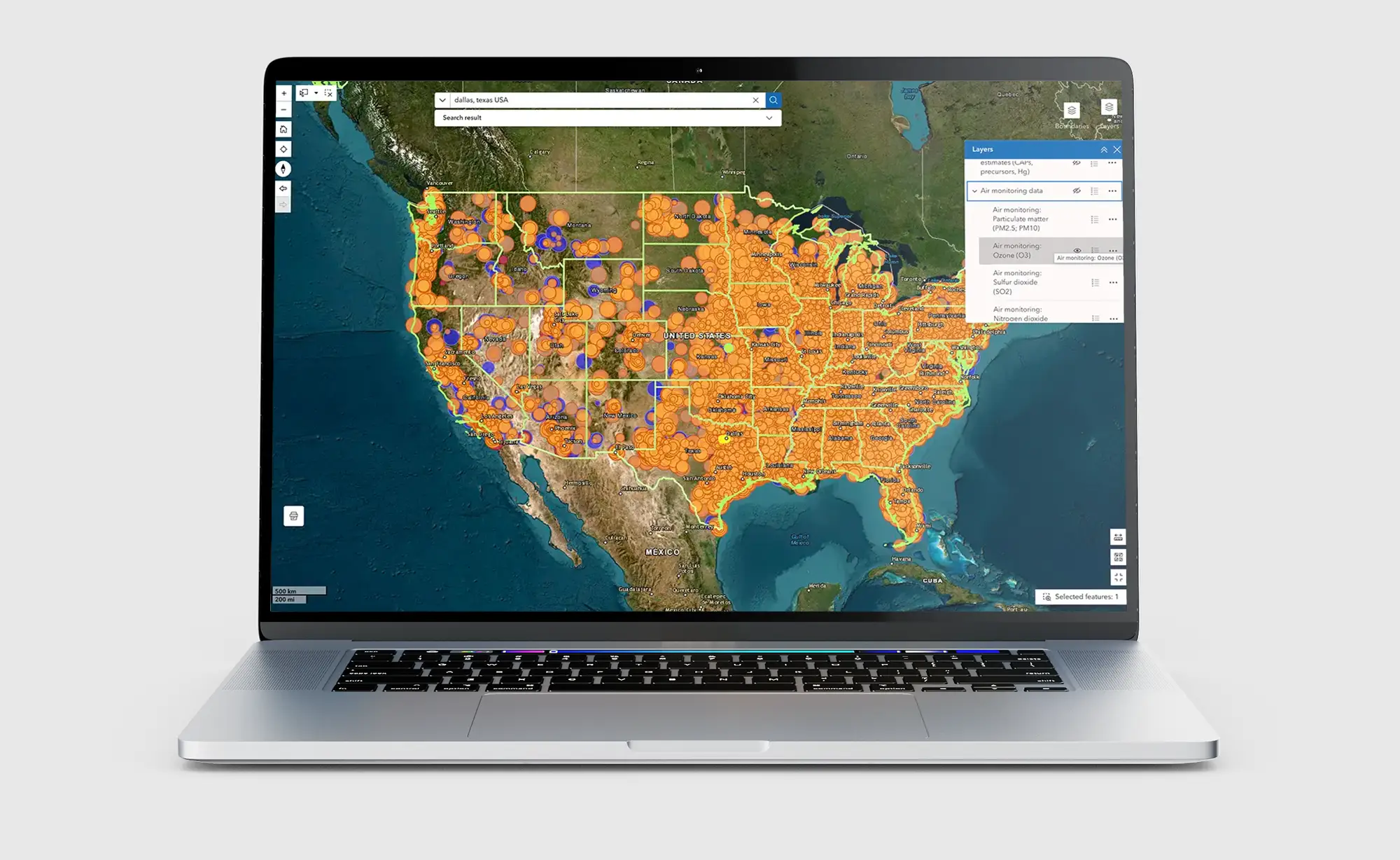
Earthjustice Action's Community Health Atlas: An Environmental Impacts Mapping Tool gives you easy access to data on pollution sources, environmental quality, natural hazards, socioeconomic conditions, demographic characteristics, and health status for communities across the country. It enables users to stay informed about the environment around their communities and supports their advocacy efforts. Try using the Community Health Atlas now.
The Community Health Atlas brings together environmental, health, demographic, and socioeconomic data from government and academic sources to enable community members and advocates to get a detailed picture of the environmental, physical, and social stressors that may contribute to health impacts in their communities. In addition to obtaining data on pollution sources and environmental conditions, users can identify social and physical stressors, estimate the size of sensitive populations (e.g., children, the elderly, people with certain health conditions), and assess the prevalence of other factors that impact people's health and access to care (e.g., lack of health insurance, language barriers, household income, etc.)
Want to know how many schools are within a 3-mile radius of a specific pollution source? Or get data on releases of hazardous air pollutants within 5 miles of your home? Use the "Find near" function to find data on community and industrial infrastructure, polluters and other types of facilities within a chosen radius. The Community Health Atlas also allows you to measure the distance between any two points (such as the distance between your home and a polluting facility) and measure any area of interest.
With our Community Health Atlas, you can map and display information on:
- Pollution sources and toxic releases
- Regulatory violations by industrial facilities and public water systems
- Air monitor locations and monitoring data
- Superfund site locations
- Community infrastructure (schools, hospitals, nursing homes, mobile home parks, park areas)
- Industrial and commercial infrastructure (power plants, ports, airports, etc.)
- Health, socioeconomic and demographic profiles for congressional districts
- Other health, vulnerability, resilience, and natural hazard risk indices
- And more...
Disclaimer
The data provided in the Community Health Atlas (CHA) have been sourced from government, academic and private sources and are provided as a public resource by Earthjustice Action without endorsement by any other organization or entity. While efforts have been made to ensure the accuracy of the data, Earthjustice Action makes no warranties, expressed or implied, concerning the accuracy, completeness or suitability of the data. The data and information in the CHA are not to be construed as legal advice.
Environmental, health, socioeconomic, and demographic data are dynamic and subject to change at any time. Certain demographic data are provided for informational purposes only and users may choose to review only some of the information provided in the tool. Users are directed to consult the original data sources to ensure they obtain the most recent data. Where the data provided are the result of calculations performed by Earthjustice Action, this is indicated in the notes accompanying the data. Earthjustice Action shall not be held liable for improper or incorrect use of the data described and/or contained herein.